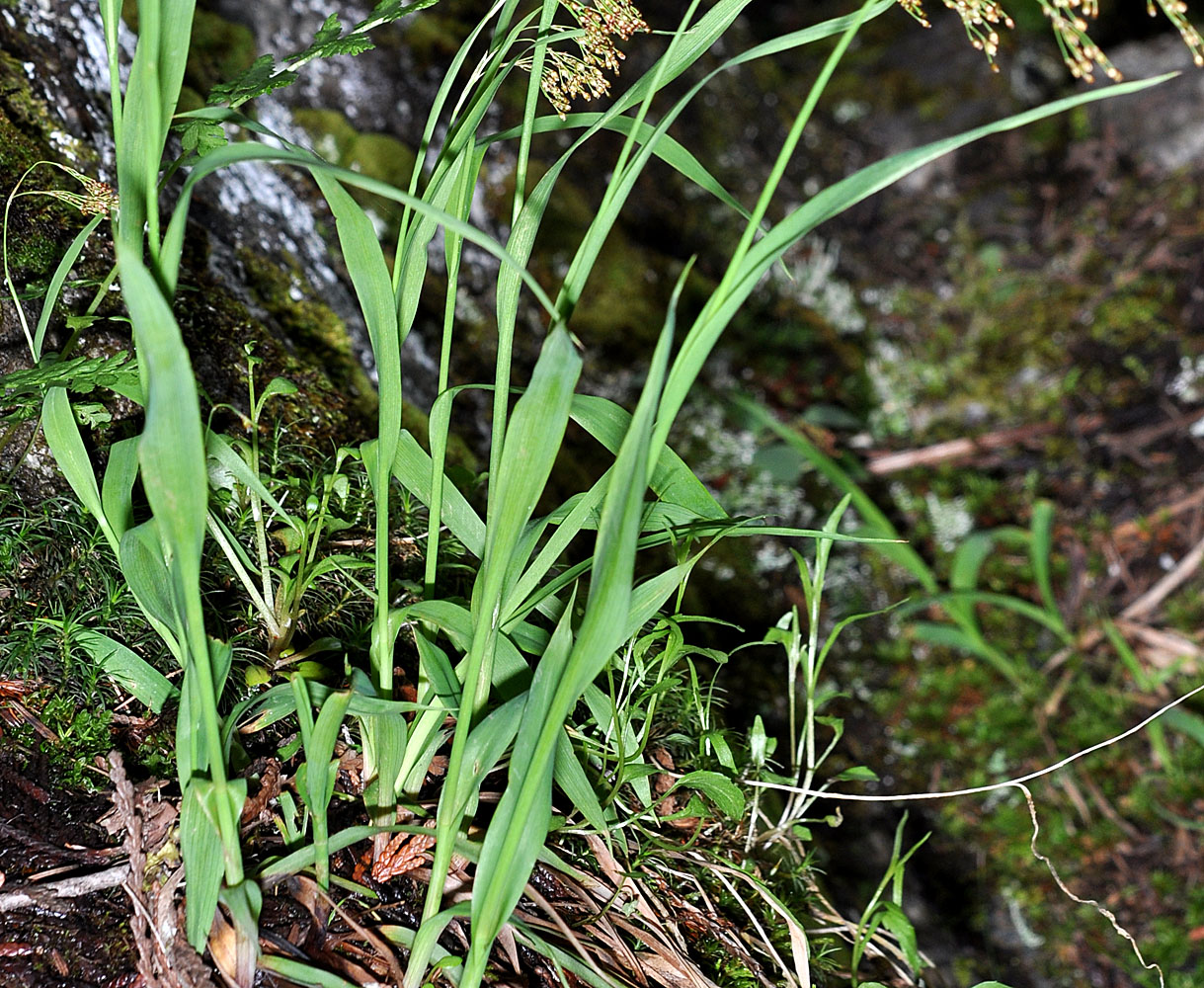
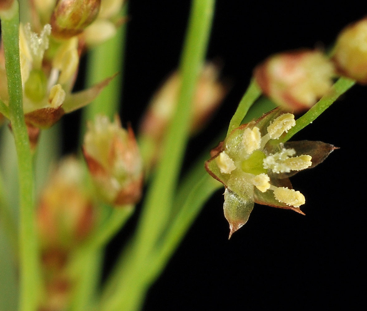
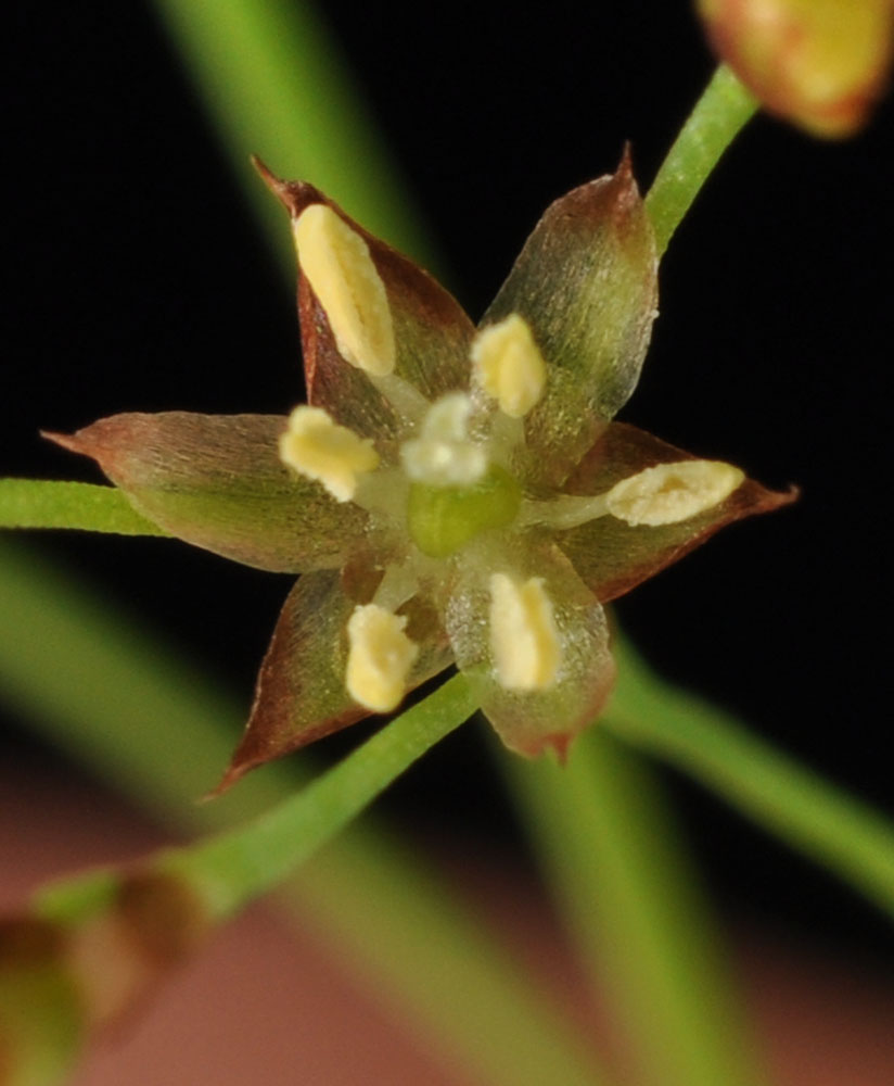
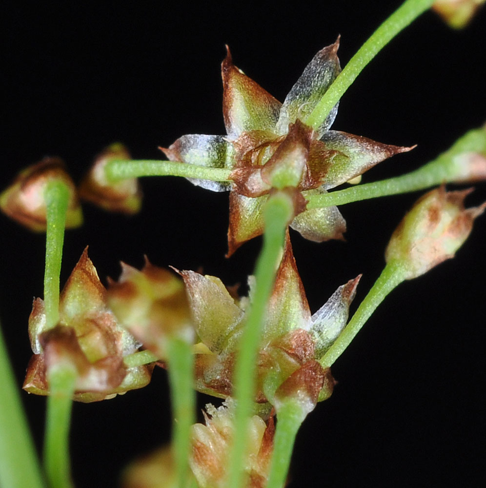
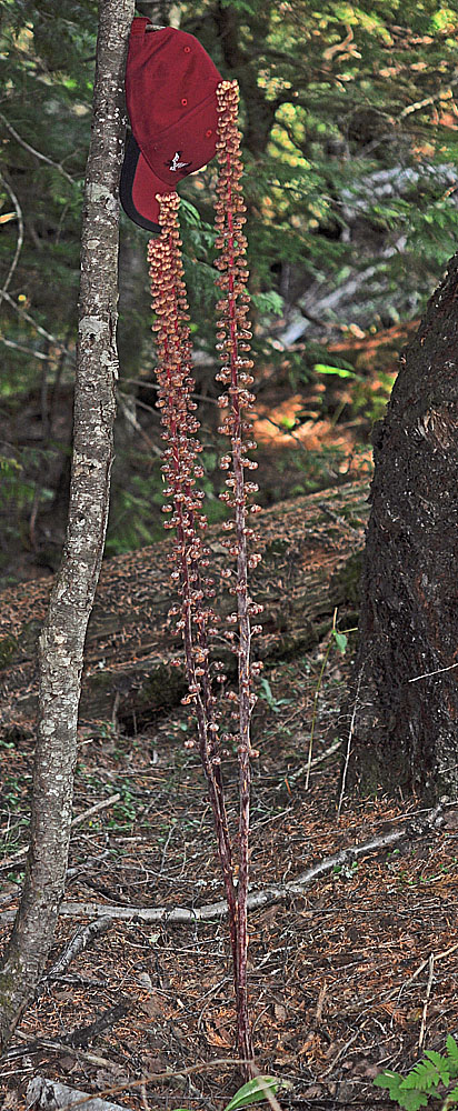
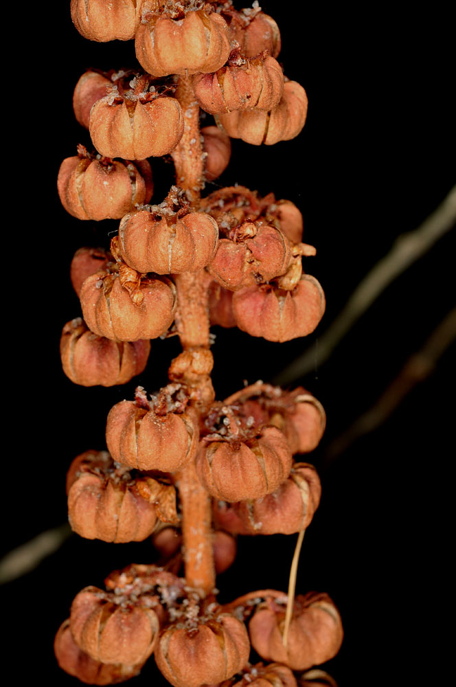
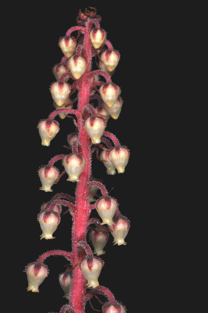
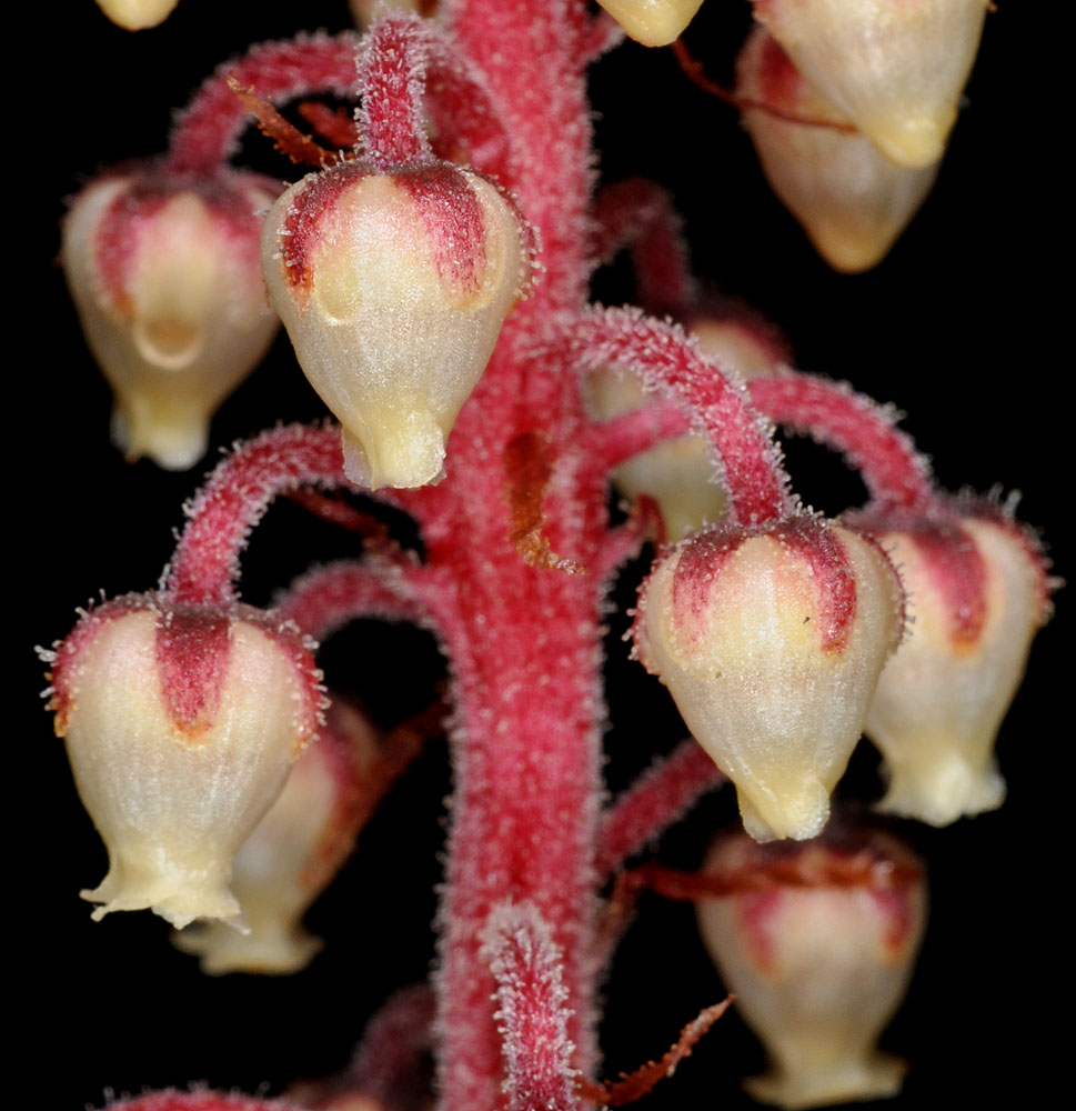
Exact locality omitted. Species status: State sensitive, USFS & BLM sensitive; Spokane Co., WA – 7/17/2010Exact locality omitted. Species status: State sensitive, USFS & BLM sensitive; Spokane Co., WA – 7/17/2010Exact locality omitted. Species status: State sensitive, USFS & BLM sensitive; Spokane Co., WA – 7/17/2010Exact locality omitted. Species status: State sensitive, USFS & BLM sensitive; Spokane Co., WA – 7/17/2010Exact locality omitted. Species status: State sensitive, USFS & BLM sensitive; Spokane Co., WA – 7/17/2010Exact locality omitted. Species status: State sensitive, USFS & BLM sensitive; Spokane Co., WA – 7/17/2010Exact locality omitted. Species status: State sensitive, USFS & BLM sensitive; Spokane Co., WA – 7/17/2010Along Hwy 3 SE of St Maries, ID; 2.5 mi NW of Jct with Hwy 6;N 47.18255 W 116.49352; Benewah Co.; 6/24/2012Exact locality omitted. Species status: State sensitive, USFS & BLM sensitive; Spokane Co., WA – 7/17/2010Along Hwy 3 SE of St Maries, ID; 2.5 mi NW of Jct with Hwy 6;N 47.18255 W 116.49352; Benewah Co.; 6/24/2012Along Hwy 3 SE of St Maries, ID; 2.5 mi NW of Jct with Hwy 6;N 47.18255 W 116.49352; Benewah Co.; 6/24/2012Along Hwy 3 SE of St Maries, ID; 2.5 mi NW of Jct with Hwy 6;N 47.18255 W 116.49352; Benewah Co.; 6/24/2012Along Hwy 3 SE of St Maries, ID; 2.5 mi NW of Jct with Hwy 6;N 47.18255 W 116.49352; Benewah Co.; 6/24/2012Along Hwy 3 SE of St Maries, ID; 2.5 mi NW of Jct with Hwy 6;N 47.18255 W 116.49352; Benewah Co.; 6/24/2012Along Hwy 3 SE of St Maries, ID; 2.5 mi NW of Jct with Hwy 6;N 47.18255 W 116.49352; Benewah Co.; 6/24/2012 44.3 air mi NE of Orofino, ID; along NF 252 ca. 0.50 mi NE of the jct with Hwy 247; N 46.83131 W 115.47782; Clearwater Co.; 6/25/2021 44.3 air mi NE of Orofino, ID; along NF 252 ca. 0.50 mi NE of the jct with Hwy 247; N 46.83131 W 115.47782; Clearwater Co.; 6/25/2021 44.3 air mi NE of Orofino, ID; along NF 252 ca. 0.50 mi NE of the jct with Hwy 247; N 46.83131 W 115.47782; Clearwater Co.; 6/25/2021 44.3 air mi NE of Orofino, ID; along NF 252 ca. 0.50 mi NE of the jct with Hwy 247; N 46.83131 W 115.47782; Clearwater Co.; 6/25/2021 44.3 air mi NE of Orofino, ID; along NF 252 ca. 0.50 mi NE of the jct with Hwy 247; N 46.83131 W 115.47782; Clearwater Co.; 6/25/2021 44.3 air mi NE of Orofino, ID; along NF 252 ca. 0.50 mi NE of the jct with Hwy 247; N 46.83131 W 115.47782; Clearwater Co.; 6/25/2021 44.3 air mi NE of Orofino, ID; along NF 252 ca. 0.50 mi NE of the jct with Hwy 247; N 46.83131 W 115.47782; Clearwater Co.; 6/25/2021 44.3 air mi NE of Orofino, ID; along NF 252 ca. 0.50 mi NE of the jct with Hwy 247; N 46.83131 W 115.47782; Clearwater Co.; 6/25/2021 44.3 air mi NE of Orofino, ID; along NF 252 ca. 0.50 mi NE of the jct with Hwy 247; N 46.83131 W 115.47782; Clearwater Co.; 6/25/2021 44.3 air mi NE of Orofino, ID; along NF 252 ca. 0.50 mi NE of the jct with Hwy 247; N 46.83131 W 115.47782; Clearwater Co.; 6/25/2021 44.3 air mi NE of Orofino, ID; along NF 252 ca. 0.50 mi NE of the jct with Hwy 247; N 46.83131 W 115.47782; Clearwater Co.; 6/25/2021