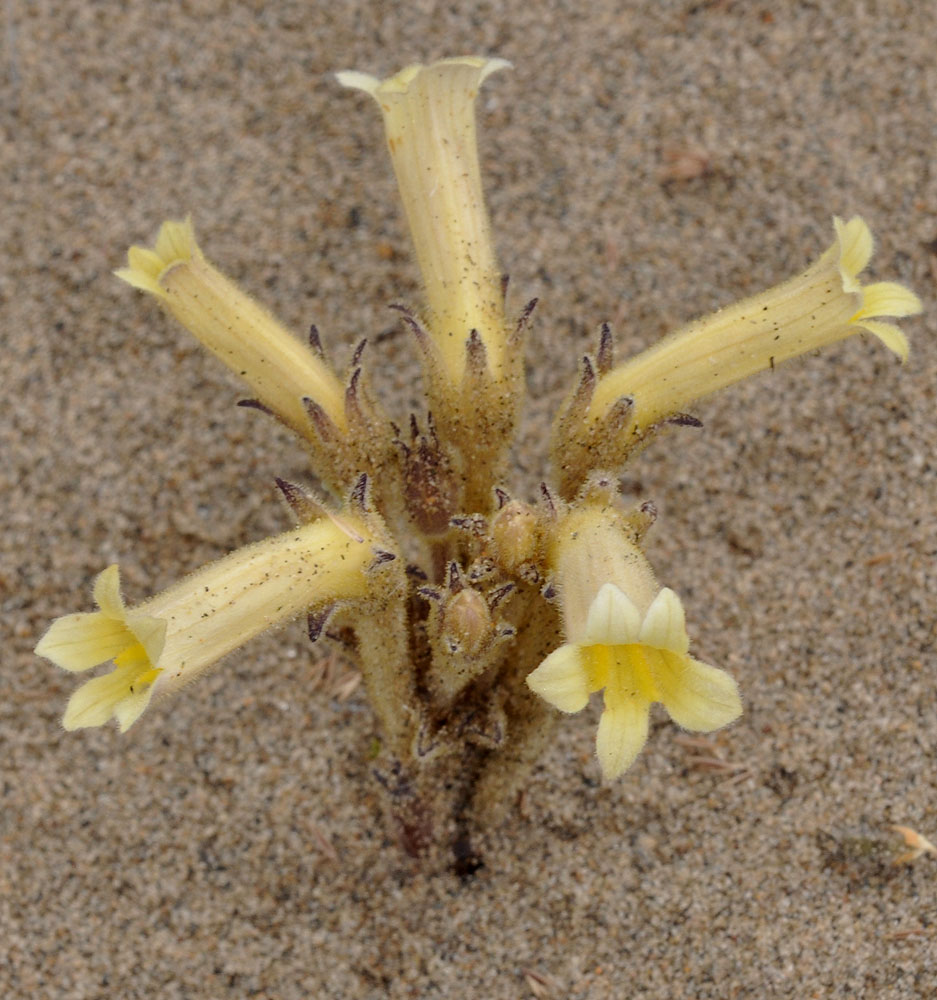
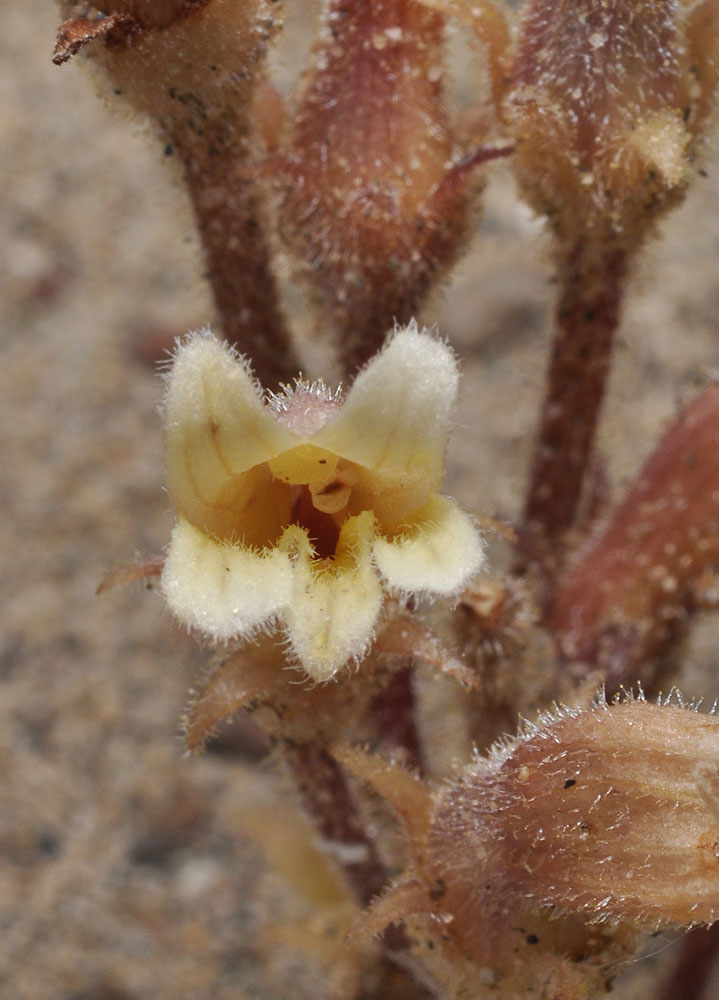
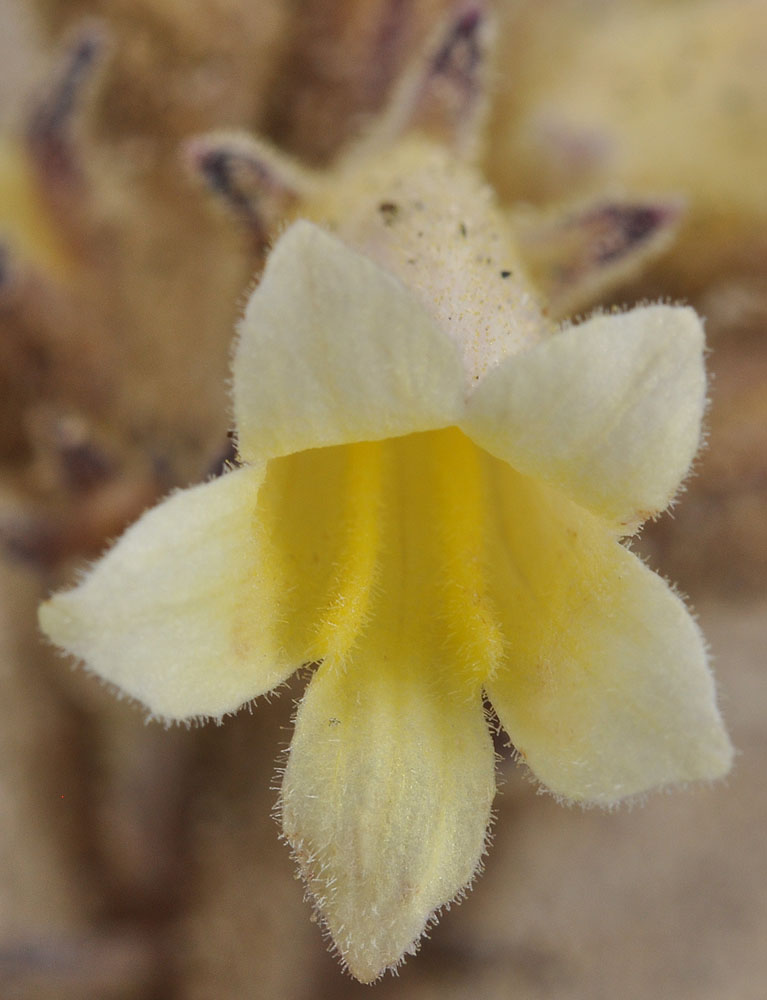
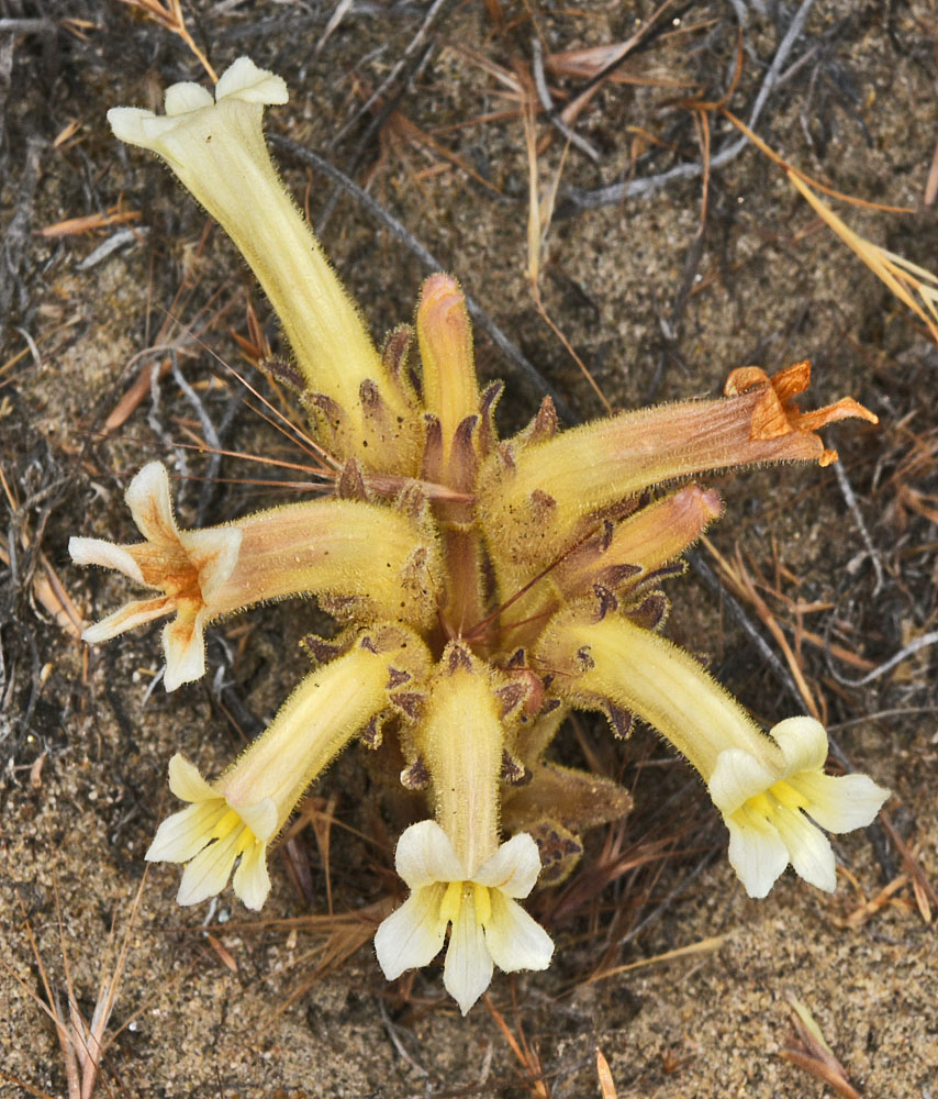
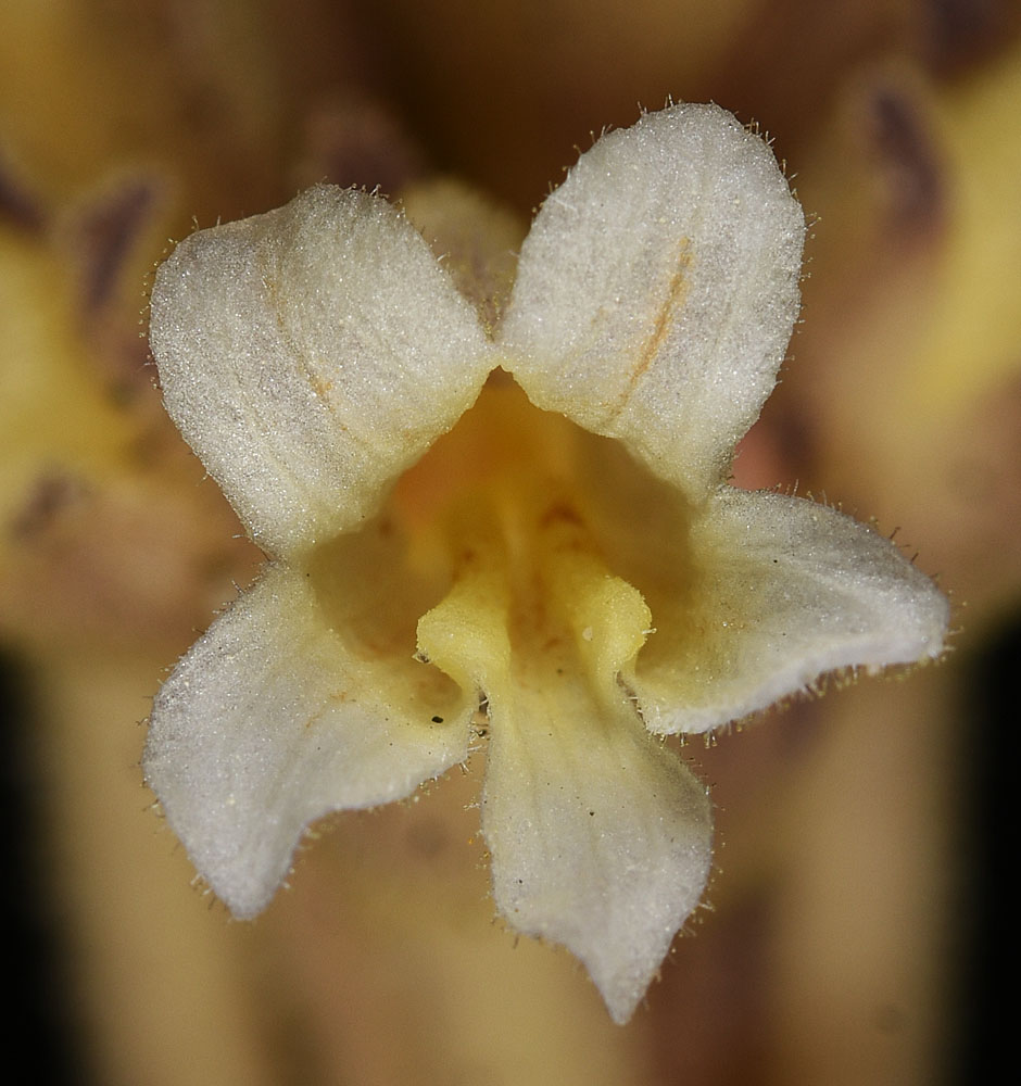
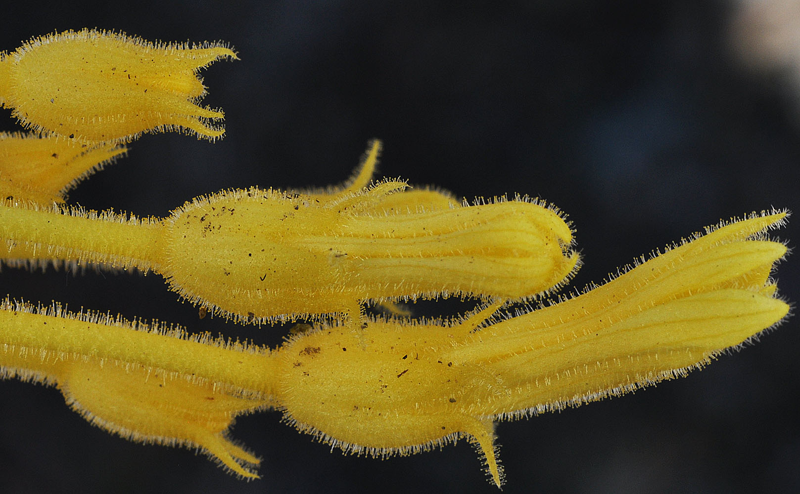
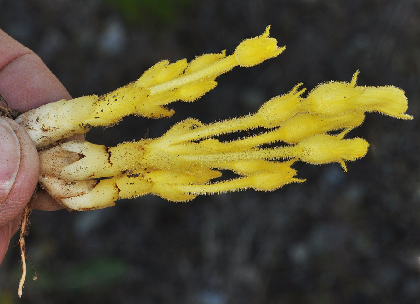
Along Hwy 243 SE of Priest Rapids Dam ca. 200 yds NW of 46.64135N 119.86538W – Grant Co., WA – 5/31/2010Along Hwy 243 SE of Priest Rapids Dam ca. 200 yds NW of 46.64135N 119.86538W – Grant Co., WA – 5/31/2010Along Hwy 243 SE of Priest Rapids Dam ca. 200 yds NW of 46.64135N 119.86538W – Grant Co., WA – 5/31/2010Along Hwy 243 SE of Priest Rapids Dam ca. 200 yds NW of 46.64135N 119.86538W – Grant Co., WA – 5/31/2010Along Hwy 243 SE of Priest Rapids Dam ca. 200 yds NW of 46.64135N 119.86538W – Grant Co., WA – 5/31/2010Along Hwy 243 SE of Priest Rapids Dam ca. 200 yds NW of 46.64135N 119.86538W – Grant Co., WA – 5/31/2010Along powerlines 0.63 air mi N of Wanapum Dam substation; sandy areas between exposed basalt rock; N 46.88928 W 119.94066; Grant Co.; 6/3/2017Along Hwy 243 SE of Priest Rapids Dam ca. 200 yds NW of 46.64135N 119.86538W – Grant Co., WA – 5/31/2010Along powerlines 0.63 air mi N of Wanapum Dam substation; sandy areas between exposed basalt rock; N 46.88928 W 119.94066; Grant Co.; 6/3/2017Along powerlines 0.63 air mi N of Wanapum Dam substation; sandy areas between exposed basalt rock; N 46.88928 W 119.94066; Grant Co.; 6/3/2017Along powerlines 0.63 air mi N of Wanapum Dam substation; sandy areas between exposed basalt rock; N 46.88928 W 119.94066; Grant Co.; 6/3/2017Gravel pit ca. 0.15 mi. W of Rogersburg, WA (near Grande Ronde R.); N 46.07657 W 116.98233; Asotin Co.; 5/10/2012Gravel pit ca. 0.15 mi. W of Rogersburg, WA (near Grande Ronde R.); N 46.07657 W 116.98233; Asotin Co.; 5/10/2012Gravel pit ca. 0.15 mi. W of Rogersburg, WA (near Grande Ronde R.); N 46.07657 W 116.98233; Asotin Co.; 5/10/2012Gravel pit ca. 0.15 mi. W of Rogersburg, WA (near Grande Ronde R.); N 46.07657 W 116.98233; Asotin Co.; 5/10/2012Gravel pit ca. 0.15 mi. W of Rogersburg, WA (near Grande Ronde R.); N 46.07657 W 116.98233; Asotin Co.; 5/10/2012Between Hwy 14 and river ca. 3.7 air mi NW of the mouth of Rock Creek; N 45.73524 W 120.53448; Klickitat Co., WA; 5/4/2014Gravel pit ca. 0.15 mi. W of Rogersburg, WA (near Grande Ronde R.); N 46.07657 W 116.98233; Asotin Co.; 5/10/2012Between Hwy 14 and river ca. 3.7 air mi NW of the mouth of Rock Creek; N 45.73524 W 120.53448; Klickitat Co., WA; 5/4/2014Just N of cliffs along Kiger Rd 2.85 air mi NW of Rome, OR airport; N 42.85961 W 117.67295; Malheur Co., OR; 6/1/2013Between Hwy 14 and river ca. 3.7 air mi NW of the mouth of Rock Creek; N 45.73524 W 120.53448; Klickitat Co., WA; 5/4/2014Between Hwy 14 and river ca. 3.7 air mi NW of the mouth of Rock Creek; N 45.73524 W 120.53448; Klickitat Co., WA; 5/4/2014Just N of cliffs along Kiger Rd 2.85 air mi NW of Rome, OR airport; N 42.85961 W 117.67295; Malheur Co., OR; 6/1/2013Between Hwy 14 and river ca. 3.7 air mi NW of the mouth of Rock Creek; N 45.73524 W 120.53448; Klickitat Co., WA; 5/4/2014Just N of cliffs along Kiger Rd 2.85 air mi NW of Rome, OR airport; N 42.85961 W 117.67295; Malheur Co., OR; 6/1/2013Just N of cliffs along Kiger Rd 2.85 air mi NW of Rome, OR airport; N 42.85961 W 117.67295; Malheur Co., OR; 6/1/2013Between Hwy 14 and river ca. 3.7 air mi NW of the mouth of Rock Creek; N 45.73524 W 120.53448; Klickitat Co., WA; 5/4/2014Between Hwy 14 and river ca. 3.7 air mi NW of the mouth of Rock Creek; N 45.73524 W 120.53448; Klickitat Co., WA; 5/4/2014Just N of cliffs along Kiger Rd 2.85 air mi NW of Rome, OR airport; N 42.85961 W 117.67295; Malheur Co., OR; 6/1/2013Just N of cliffs along Kiger Rd 2.85 air mi NW of Rome, OR airport; N 42.85961 W 117.67295; Malheur Co., OR; 6/1/2013